How to Explore Ramsey Lake Trails Like a Local Expert

This post covers everything needed to explore Ramsey Lake's trail system like someone who grew up walking these paths. Readers will learn the exact distances between access points, seasonal conditions to watch for, parking locations that locals actually use, and practical tips that transform a basic walk into a proper Northern Ontario experience.
Understanding the Ramsey Lake Trail System
Ramsey Lake sits at the heart of Greater Sudbury, covering 792 hectares with a shoreline perimeter of approximately 22 kilometres. The primary trail network spans roughly 10 kilometres of maintained pathways that connect Science North, Bell Park, and the Lake Laurentian Conservation Area. Unlike typical urban walking paths, this system traverses the Canadian Shield, which means elevation changes, exposed bedrock, and terrain that demands proper footwear year-round.
The trail splits into three distinct sections, each with different characteristics:
- The Jim Gordon Walkway: Running 2.1 kilometres from Science North to Bell Park, this fully paved section accommodates wheelchairs, strollers, and cyclists. The boardwalk sections sit approximately 1.2 metres above the waterline, providing clear views of the lake without disturbing the shoreline ecosystem.
- The Bell Park to Lake Laurentian segment: This 3.4-kilometre stretch transitions from paved surfaces to compacted gravel and natural pathways. Elevation gain totals 45 metres over this distance, with the steepest grade (8%) occurring near the southwestern corner of the lake.
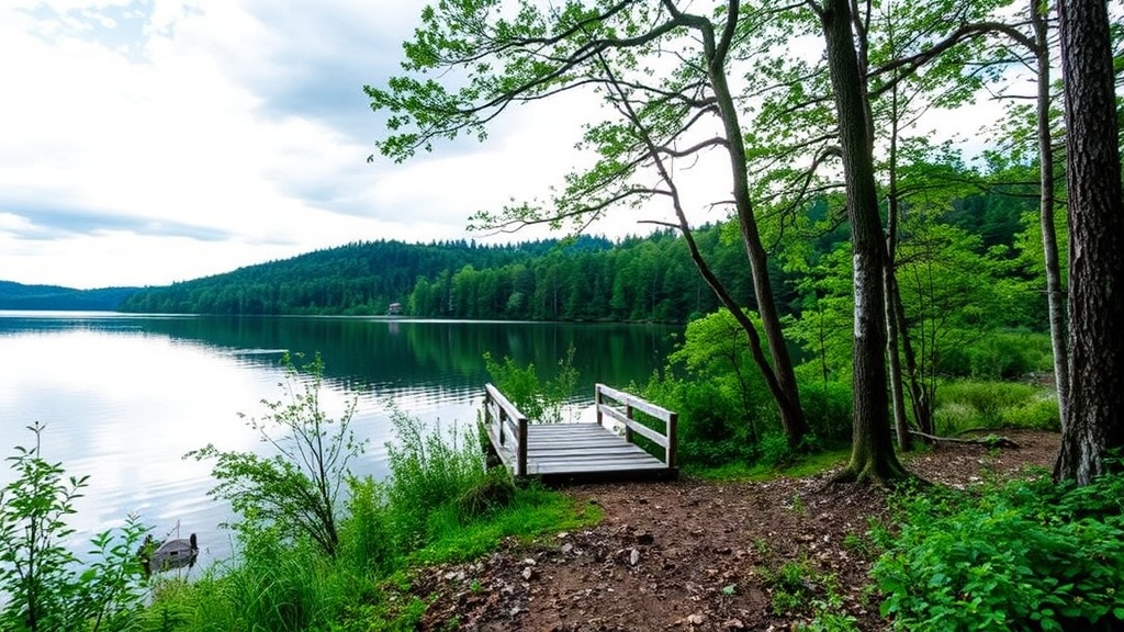
- The Lake Laurentian Conservation trails: These unpaved paths extend another 4.5 kilometres through mixed boreal forest, with some sections requiring navigation over exposed granite.
Best Access Points and Parking
Locals avoid the main Science North lot during peak hours (10:00 AM to 2:00 PM on weekends) because the $5.00 parking fee and tourist traffic create unnecessary delays. Instead, three alternative access points offer better experiences:
Bell Park Main Entrance
The parking lot at 450 Elizabeth Street contains 89 spaces and fills by 11:00 AM on summer Saturdays. Arrival before 9:00 AM guarantees a spot and provides the calmest water conditions for photography. From this lot, the trailhead sits 150 metres east, marked by the Elizabeth W. Dowswell Memorial Trail signage.
Science North Alternative
Instead of the main lot, park at the Ramsey Lake Road pull-off approximately 400 metres west of the Science North entrance. This unpaved area accommodates 12 vehicles and provides immediate trail access without crossing the busy intersection at Ramsey Lake Road and Killarney Street.
Lake Laurentian Conservation Area
The Nature Chalet parking at 2309 South Bay Road offers 34 spaces and serves as the quietest entry point. This access bypasses the busier eastern sections entirely, depositing hikers directly into the forested western trails. The chalet itself operates from 9:00 AM to 5:00 PM Tuesday through Sunday (closed Mondays) and provides washroom facilities and trail maps.
Seasonal Considerations and Timing
Ramsey Lake trails function as four distinct experiences throughout the year, each requiring different preparation.
Spring (April through May)
Snowmelt creates significant water pooling on unpaved sections, particularly between kilometre markers 4.2 and 5.8 where the trail passes through low-lying areas. The boardwalk sections may remain icy until mid-May due to shade from the surrounding white pines. Muddy conditions persist through most of May; waterproof boots with aggressive tread patterns become essential.
Summer (June through August)
The paved Jim Gordon Walkway receives full sun exposure from 11:00 AM to 4:00 PM, with surface temperatures reaching 42°C on July afternoons. The western forested trails remain 8 to 12 degrees cooler due to canopy cover. Black flies peak in late May and early June, while mosquito populations surge during July. The hours between 6:00 AM and 9:00 AM offer optimal conditions—cool temperatures, minimal insects, and the highest probability of wildlife sightings.
Autumn (September through October)
Fall colour peak typically occurs during the first two weeks of October, though elevation variations create a three-week window of prime viewing. The sugar maple and yellow birch along the Lake Laurentian section produce the most dramatic displays. Morning frost becomes common by mid-October, creating slippery conditions on wooden boardwalk sections until approximately 10:00 AM.
Winter (November through March)
The Greater Sudbury Trail Planning Committee maintains 6.8 kilometres of the trail system for winter use, including the entire Jim Gordon Walkway and portions of the Lake Laurentian paths. Grooming occurs every Tuesday and Friday, with tracks set for classic cross-country skiing on the 3.2-kilometre Lake Laurentian ski loop. Ice formation on the lake typically occurs by late November, though the trail remains safe for hiking and snowshoeing regardless of ice conditions. Temperatures below -25°C demand face protection; the wind coming off the frozen lake amplifies the cold significantly.
Essential Gear and Preparation
The exposed Canadian Shield bedrock creates unique demands that differ from typical urban trails. Required equipment includes:
- Footwear with ankle support: The granite sections between kilometres 6.2 and 7.8 feature uneven surfaces with ankle-height cracks. Trail runners with aggressive outsoles work during dry conditions; hiking boots become necessary when surfaces are wet or icy.
- Water access: No potable water sources exist along the trail. The round-trip distance from Bell Park to the Lake Laurentian trail terminus and back covers 9.4 kilometres. Carry minimum 750 millilitres during summer months.
- Navigation tools: Cell service drops to one bar or less along the western forested sections. Download offline maps from the Greater Sudbury Open Data portal before departing.
- Bear awareness equipment: Black bears inhabit the Lake Laurentian Conservation Area. Carry bear spray during May through October, and understand proper food storage if picnicking.
Wildlife and Ecology
The trail passes through three distinct ecological zones. The eastern section near Science North features planted Norway spruce and trembling aspen that date to the 1970s reclamation efforts. The central portion around Bell Park contains old-growth white pine specimens exceeding 35 metres in height, including the marked "Heritage Tree" estimated at 180 years old. The western Lake Laurentian section represents undisturbed boreal forest with jack pine, black spruce, and balsam fir.
Common wildlife sightings include:
- Beaver: Active lodges exist at kilometre markers 2.4 and 5.1. Dawn and dusk provide the best viewing opportunities.
- Osprey: Three nesting platforms are visible from the trail, with active nesting occurring from May through August.
- White-tailed deer: Populations concentrate near the South Bay Road access point, particularly during early morning hours.
Connecting Attractions and Extensions
The trail system connects to several destinations that extend a basic hike into a full-day exploration.
Science North
Located at kilometre 0.0, this science centre operates from 10:00 AM to 4:00 PM (hours extend to 6:00 PM during July and August). The building itself sits 60 metres back from the shoreline, connected to the trail via a paved path. The IMAX theatre and planetarium require separate admission from the main science centre.
Bell Park
This 18-hectare park contains the William Bell Gazebo, constructed in 1986, and the Grace Hartman Amphitheatre, which hosts the Northern Lights Festival Boreal each July. The park beach operates from June 15 through August 31, with lifeguards on duty from 11:00 AM to 6:00 PM daily.
Lake Laurentian Conservation Area
Beyond the main trail, this 970-hectare conservation area contains 40 kilometres of additional hiking trails. The 5.2-kilometre "Lily Creek Trail" loop offers the best introduction, passing through wetland boardwalks and mixed forest. Trail markers use the standard yellow blaze system.
Safety Considerations
Several hazards require attention beyond the typical trail risks:
Weather exposure: The 2.1-kilometre Jim Gordon Walkway offers zero shade and no shelter. Sudbury experiences approximately 12 afternoon thunderstorms annually during June through August. Check radar before departure; the exposed boardwalk becomes dangerous during lightning events.
Ice conditions: Never assume lake ice safety. Ramsey Lake reaches depths of 64 metres, creating variable ice thickness. The City of Greater Sudbury does not monitor ice conditions for recreational use. Remain on marked trails and away from the shoreline ice.
Tick awareness: While black-legged tick populations remain lower than in southern Ontario, cases of Lyme disease have increased in the Sudbury District. Perform tick checks after any off-trail exploration, particularly in tall grass areas near kilometre 5.8.
Local Protocol and Etiquette
The trail serves as both a recreational resource and a commuting corridor. During weekday mornings (7:00 AM to 9:00 AM), cyclists and pedestrians share the path between the residential areas and downtown. Keep right, pass left, and announce approach when overtaking.
The boardwalk sections prohibit bicycles and skateboards. Fishing from the boardwalk is permitted with a valid Ontario Outdoors Card and fishing licence; the daily catch limit for walleye is two fish with a possession limit of four.
Photography etiquette matters during loon nesting season (May through July). Maintain minimum 50-metre distance from any nesting birds, and avoid using drone equipment within 150 metres of the shoreline.
Sample Itineraries
The Classic Local Loop (2.5 hours)
Start at the Bell Park Elizabeth Street entrance. Walk the Jim Gordon Walkway to Science North (2.1 km), return via the same route, then circle the Bell Park peninsula (1.2 km). Total distance: 5.4 kilometres. Best during weekday mornings to avoid Science North school group traffic.
The Full Circuit (4 hours)
Begin at the Lake Laurentian Conservation Area Nature Chalet. Follow the trail east through the forested section, continue past Bell Park, reach Science North, then return. Total distance: 9.4 kilometres. This route covers all three ecological zones and provides the most complete experience of the lake's varied character.
The Winter Ski (1.5 hours)
Access via the South Bay Road ski trailhead. Follow the groomed 3.2-kilometre Lake Laurentian ski loop, then extend onto the Jim Gordon Walkway for an additional 2.1 kilometres of flat skating-ski terrain. Equipment rentals are available at the Nature Chalet on weekends from 10:00 AM to 4:00 PM.
Final Practical Notes
The Ramsey Lake trail system operates as a year-round public resource maintained by the City of Greater Sudbury and the Lake Laurentian Conservation Area. Trail condition updates appear on the City of Greater Sudbury website under the "Parks and Trails" section. Winter grooming reports post by 8:00 AM daily during ski season.
For those new to the area, the trail reveals why Sudbury residents defend the city's quality of life so vigorously. Where else does a city of 166,000 people provide immediate access to old-growth forest, a lake large enough to generate its own weather patterns, and geological features that date back 2.7 billion years—all within a 10-minute drive from downtown?
"The trail around Ramsey Lake isn't just a path through the city. It's a path through the geological history of the Canadian Shield, and understanding that context transforms every step into something more meaningful."
Steps
- 1
Choose Your Starting Point at Bell Park or Science North
- 2
Pick the Right Trail Route for Your Fitness Level
- 3
Discover Hidden Gems and Scenic Viewpoints Along the Way